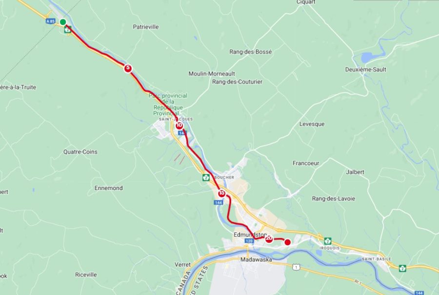
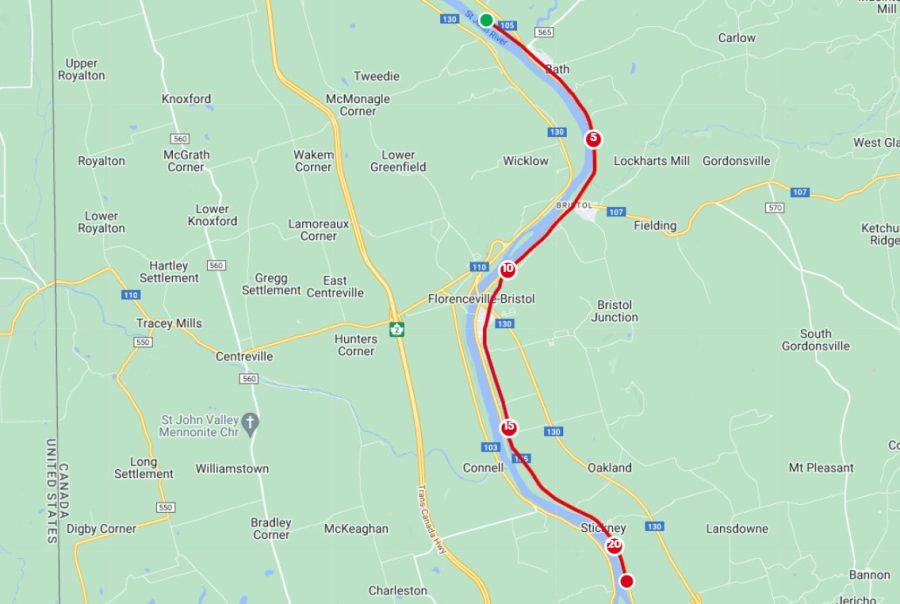
Leg 1: Le Madawaska, May 4 at 8:00 am
Le Madawaska kicks off our journey with a scenic route tracing the tranquil Madawaska River. Amidst the charming villages and lush forests of New Brunswick, expect a gentle terrain with rolling hills, offering a picturesque start to your half marathon adventure.
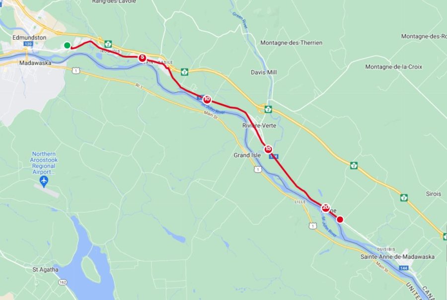
Leg 2: La Rivière-Verte, May 4 at 4:00 pm
La Rivière-Verte invites you to follow the gentle curves of the “Green River”, meandering through verdant landscapes and quaint hamlets. With its undulating terrain and refreshing vistas, this leg promises a serene yet invigorating half marathon experience amidst nature’s embrace.
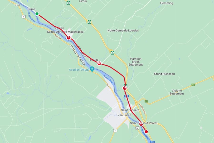
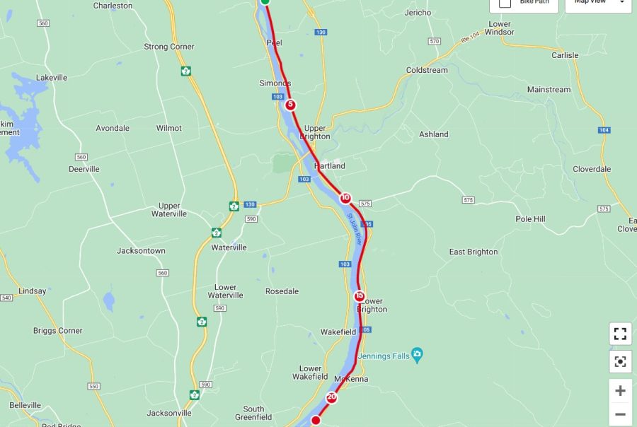
Leg 3: La Saint-Léonard, May 5 at 8:00 am
La Saint-Léonard guides you through the historic town of Saint-Léonard, where rich Acadian heritage meets stunning natural beauty. Prepare for a mix of flat stretches and rolling hills, with captivating views of the surrounding countryside, making for an exhilarating half marathon journey.
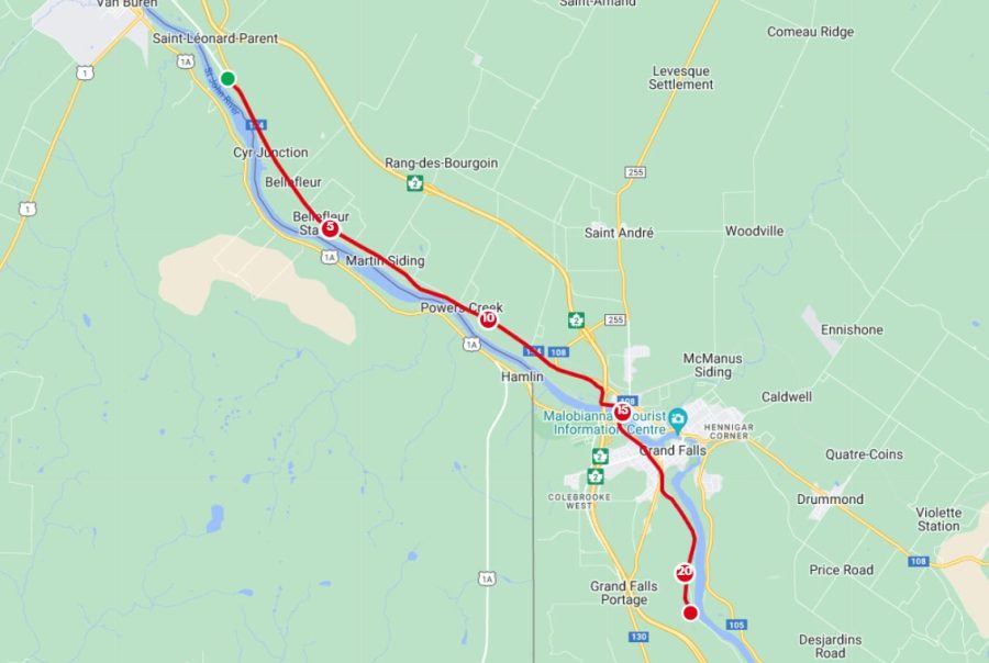
Leg 4: Tour de Grand Sault, May 5 at 4:00 pm
Embark on the Tour de Grand Sault through the captivating landscapes surrounding Grand Falls. With a mix of gentle inclines and thrilling descents, this leg offers panoramic views of cascading waterfalls and lush forests, promising an unforgettable half marathon adventure in New Brunswick.
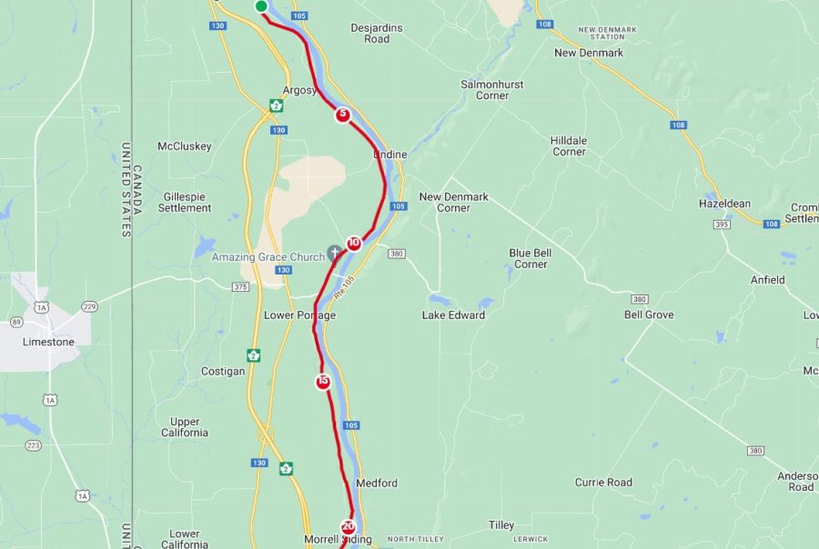
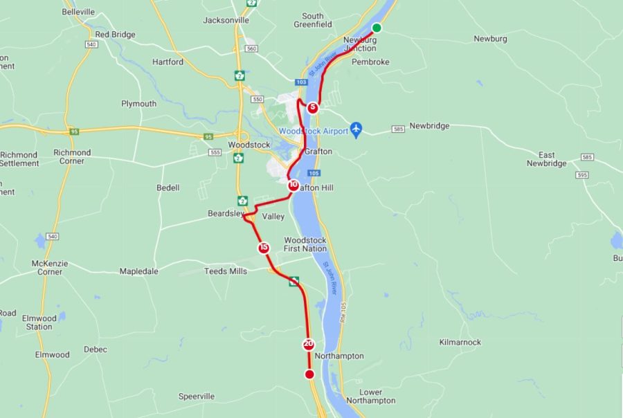
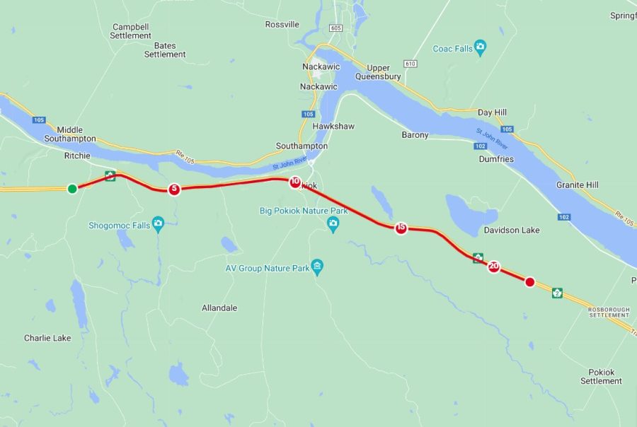
Leg 5: Trail Time, May 6 at 8:00 am
Trail Time takes you on a rugged journey through the wilderness along the St John River, following the footsteps of explorers past. Navigate winding trails and challenging terrain, surrounded by towering trees and echoing birdcalls, for an adrenaline-fueled half marathon adventure amidst the untamed beauty of NB.
Leg 6: The River Run, May 6 at 4:00 pm
The River Run winds through the heart of Perth Andover, tracing the shores of the majestic Saint John River. Experience the town’s charm as you tackle gentle slopes and riverfront paths, with stunning vistas and a welcoming community to push you through this half marathon journey.
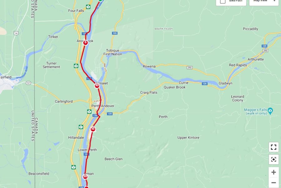
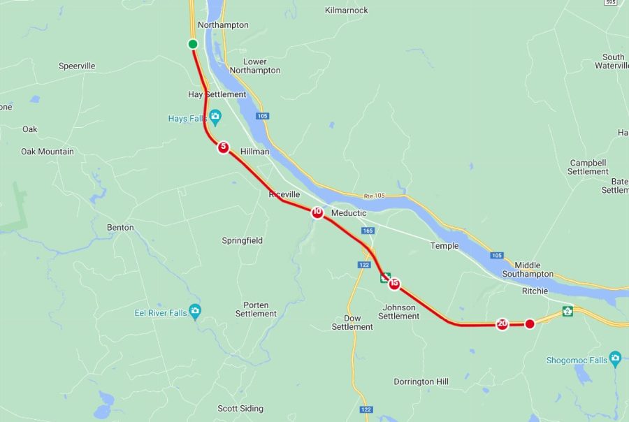
Leg 7: Downstream Dance, May 7 at 8:00 am
Downstream Dance leads you on a rhythmic journey along the serene waters, passing through picturesque locales like Maplehurst, Upper Kent, and Upper Wicklow. Enjoy a gentle course with scenic vistas of rolling hills and tranquil riverside scenes, making for a harmonious half marathon experience in New Brunswick
Leg 8: The Florenceville May 7 at 4:00 pm
The Florenceville guides you through the heart of Florenceville, renowned as the french fry capital of the world. Along this flavorful route, expect gentle terrain and charming countryside views, with the aroma of freshly harvested potatoes filling the air, making for a delightful early-evening run.
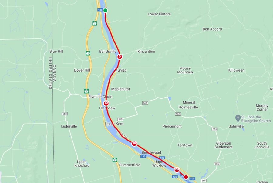
Leg 9: The Heartland Trot, May 8 at 8:00 am
The Heartland Trot invites you to explore the picturesque heartland of New Brunswick. With rippling hills and peaceful country roads, this leg offers a charming journey through quaint villages and verdant farmlands, promising a soulful half marathon experience.
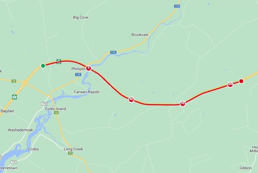
Leg 10: Woodstock ’24, May 8 at 4:00 pm
Woodstock ’24 beckons you to conquer its challenging course through the captivating Woodstock region. Brace yourself for steep ascents and thrilling descents amidst breathtaking vistas of rolling hills and lush forests, promising an exhilarating and unforgettable half marathon adventure.
Leg 11: The Greer Creek Run, May 9 at 8:00 am
The Greer Creek Run immerses you in a rugged wilderness adventure through the scenic Greer Creek area. Prepare for a challenging course with steep climbs and exhilarating descents, offering breathtaking views of cascading waterfalls and dense forest, promising an adrenaline-fueled run.
Leg 12: Acadian Forest, May 9 at 4:00 pm
Acadian Forest envelops you in the pristine beauty of New Brunswick’s iconic woodland. Navigate through towering trees and winding trails, encountering diverse flora and fauna along the way. With moderate inclines and scenic vistas, this leg promises a refreshing half marathon surrounded by nature.
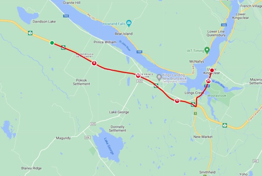
Leg 13: Joslin Falls Way, May 10 at 8:00 am
Joslin Falls Way guides you along a serene path bordered by the whispering trees and cascading waters of Joslin Falls. With gentle slopes and captivating scenery, this leg offers a tranquil yet invigorating half marathon journey, inviting you to immerse yourself in the beauty of New Brunswick’s natural wonders.
Leg 14: Run to Fredericton, May 10 at 4:00 pm
Run to Fredericton leads you on a scenic journey toward the charming capital city of New Brunswick. Traverse rolling hills and winding paths, with glimpses of historic landmarks and vibrant cityscapes along the way. This leg promises a captivating half marathon adventure, culminating in the welcoming embrace of Fredericton’s rich culture and heritage.
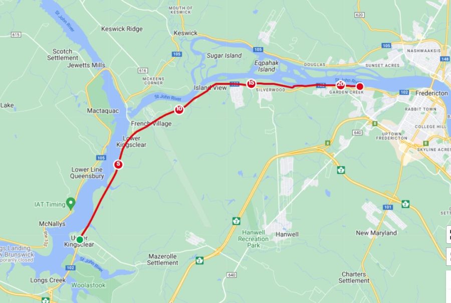
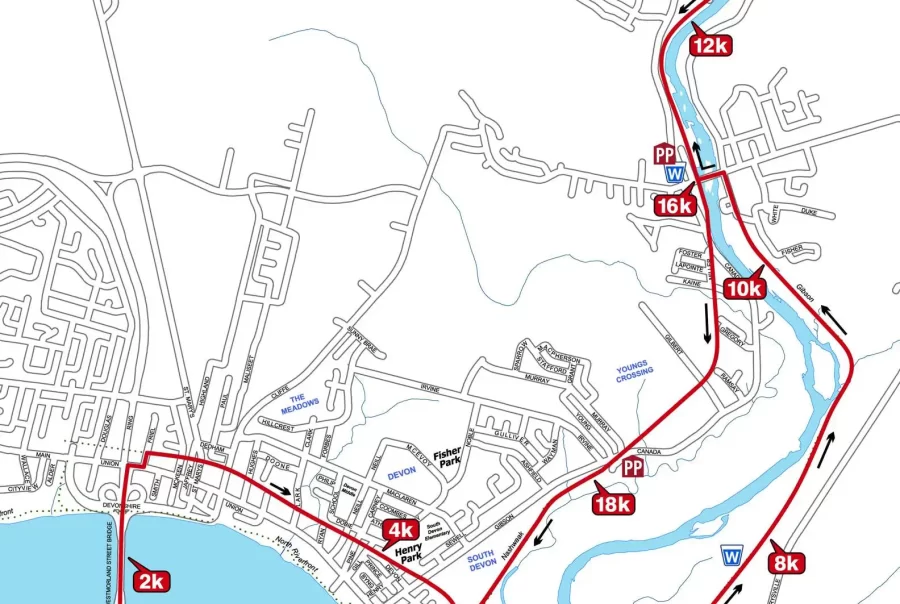
Leg 15: The Capital City, May 11 at 8:00 am
The Capital City sets the stage for a dynamic run through Fredericton’s historic streets and scenic riverfront. Enjoy a mix of urban charm and natural beauty as you traverse the city’s landmarks, with gentle inclines offering a refreshing half marathon journey filled with culture, history, and picturesque views.
Leg 16: St. John River Jig, May 11 at 4:00 pm
St. John River Jig offers a dynamic route that starts right by the Fredericton airport, where the sights and sounds of aviation accompany your run. With gentle terrain and wide-open spaces, this leg provides a refreshing running experience, with occasional glimpses of planes soaring above, adding an exhilarating touch to your journey.
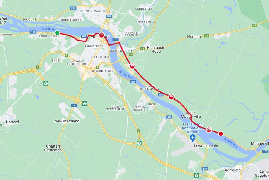
Leg 17: Fredericton Half Marathon, May 12 at 7:30 am
Join Rob and hundreds of other runners from across New Brunswick who will be participating in the Fredericton Marathon! The Egg Farmers of NB 21.1K will take you through the heart of the Capital City, where you will get to enjoy exciting cityscapes, serene river views, and feed off the energy of one NB’s most popular running events!
Leg 18: The St. John River Crossing, May 12 at 4:00 pm
The St. John River Crossing guides you on a scenic route spanning the majestic St. John River. As you run across this iconic waterway, enjoy sweeping views of the surrounding landscape, with moderate inclines adding a thrilling challenge to your half marathon. Embark on this memorable crossing, where nature’s beauty and the rhythm of your run merge into an unforgettable experience.
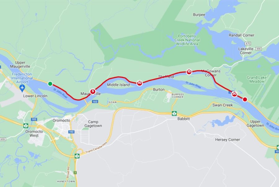
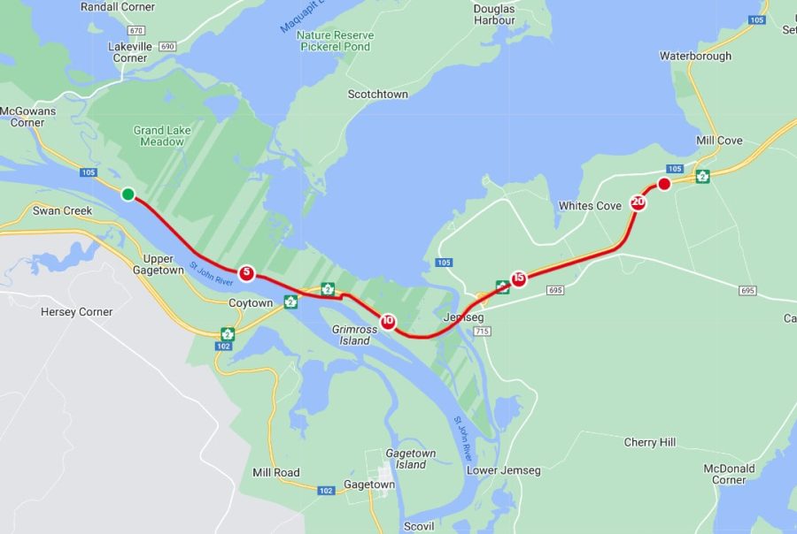
Leg 19: The Grand Lake, May 13 at 8:00 am
The Grand Lake leg unfolds along the calm shores of New Brunswick’s largest lake. With a gentle terrain and captivating waterfront views, this half marathon journey offers serene moments of reflection amidst the beauty of Grand Lake’s expansive waters, promising a peaceful and rejuvenating running experience.
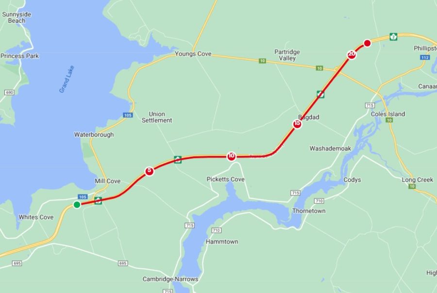
Leg 20: The Partridge Valley, May 13 at 4:00 pm
The Partridge Valley leg leads you on a scenic route paralleling the Trans-Canada Highway, offering captivating views of the surrounding valley. With moderate elevation changes and a mix of open roads and shaded trails, this half marathon promises a stunning journey through the heart of New Brunswick’s breathtaking landscapes.
Leg 21: Moose Crossing, May 14 at 8:00 am
Moose Crossing takes you on an adventurous journey through the wilds of New Brunswick. With challenging terrain and rugged trails, be prepared for exhilarating elevation changes and the possibility of encountering majestic moose in their natural habitat, making for an unforgettable half marathon experience amidst untamed beauty.
Leg 22: Pine Tree Way, May 14 at 4:00 pm
Pine Tree Way guides you through a serene forested path adorned with towering pine trees. With gentle slopes and the soothing fragrance of evergreens, this leg offers a tranquil half marathon journey amidst the natural splendor of New Brunswick’s woodlands, inviting you to reconnect with nature as you run.
Leg 23: Run to Moncton, May 15 at 8:00 am
Run to Moncton leads you on a scenic journey towards the vibrant city of Moncton. With gently rolling terrain and charming countryside vistas, this leg offers a delightful run as you approach the bustling energy and excitement of Moncton, promising a refreshing blend of rural peacefulness and urban buzz.
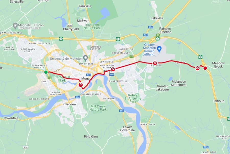
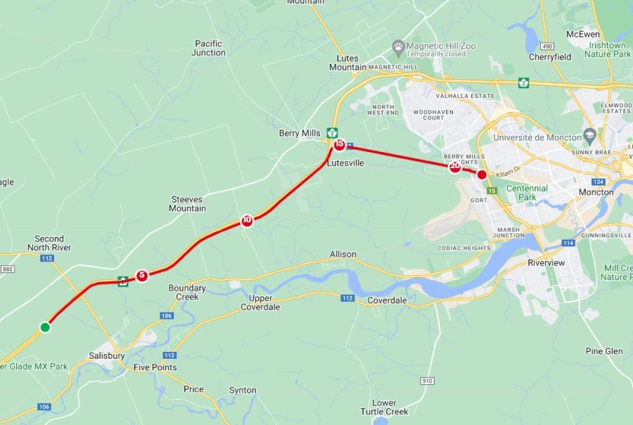
Leg 24: Les Aigles Bleus, May 15 at 4:00 pm
Les Aigles Bleus takes you on a spirited run through the heart of Moncton, home to the Université de Moncton’s Les Aigles Bleus. With a mix of urban streets and scenic pathways, this leg offers a dynamic running experience amidst the vibrant energy of the city, promising an electric and memorable half marathon.
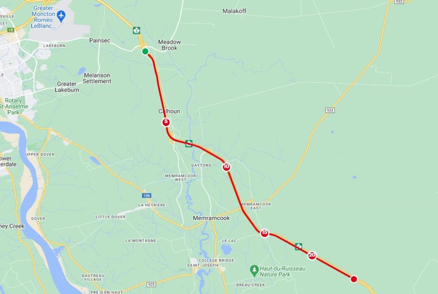
Leg 25: Le MemRuncook, May 16 at 8:00 am
The MemRuncook embarks you on a playful yet challenging journey through the scenic landscapes surrounding Memramcook. With rolling hills and scenic views, this leg offers a memorable running experience, combining wordplay with the beauty of New Brunswick’s countryside for a truly unique half marathon.
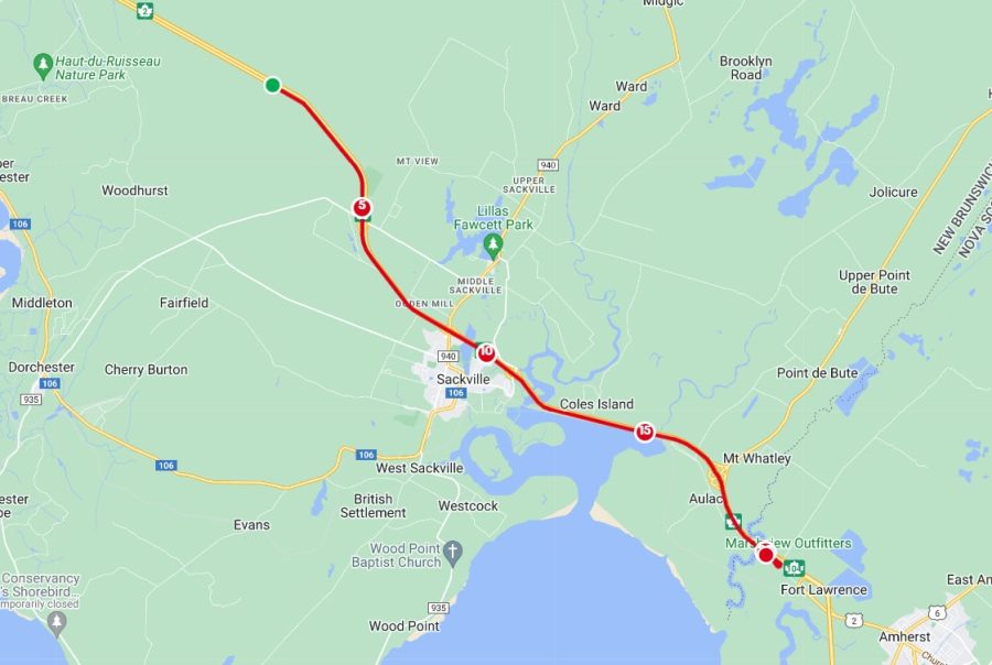
Leg 26: The Tantramar Finisher, May 16 at 4:00 pm
The Tantramar Finisher wraps up the RunWithRob journey with a triumphant run to the Nova Scotia welcome sign. With a mix of exhilarating descents and gentle slopes, this leg symbolizes the culmination of the journey, offering a fitting finale as you cross the finish line and bid farewell to New Brunswick’s scenic landscapes, marking the end of an unforgettable adventure.